In collaboration with the framework of the government-funded Commonwealth Marine Economies (CME) programme, we have made available shoreline change data in St Vincent and the Grenadines, our first test to measure change over non-beachy shorelines. We assess the capabilities of Sentinel-1 SAR and Sentinel-2 optical satellite data as a rapid method for mapping and quantify changes in shoreline over the period 2016 to 2020.
The data is now available on our data portal here in shapefile and geodatabase format.
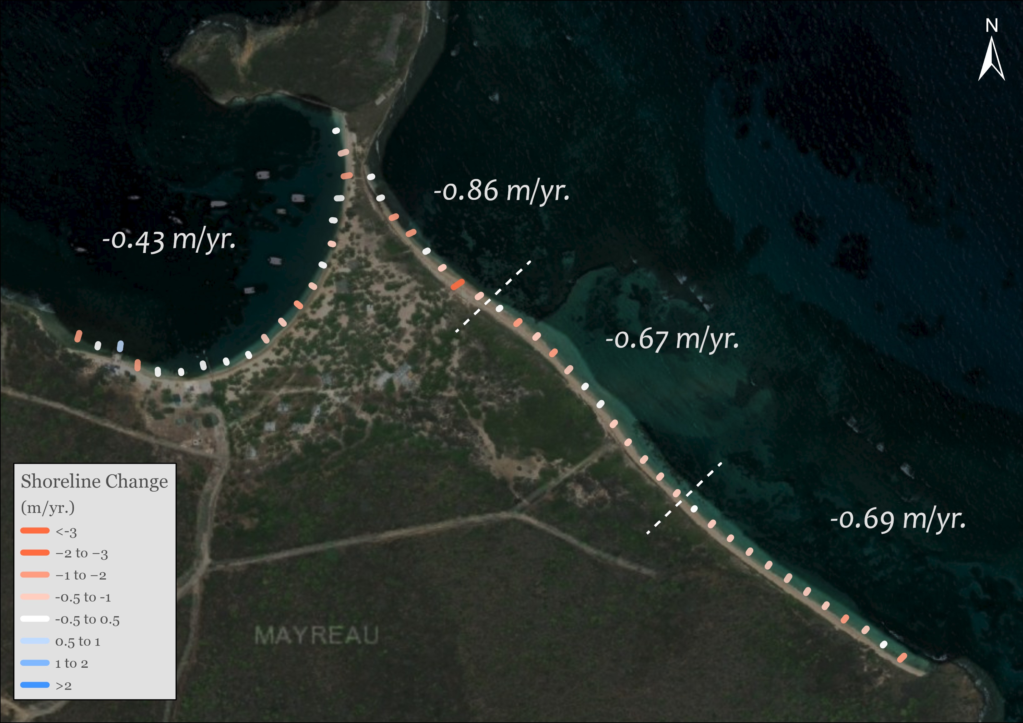
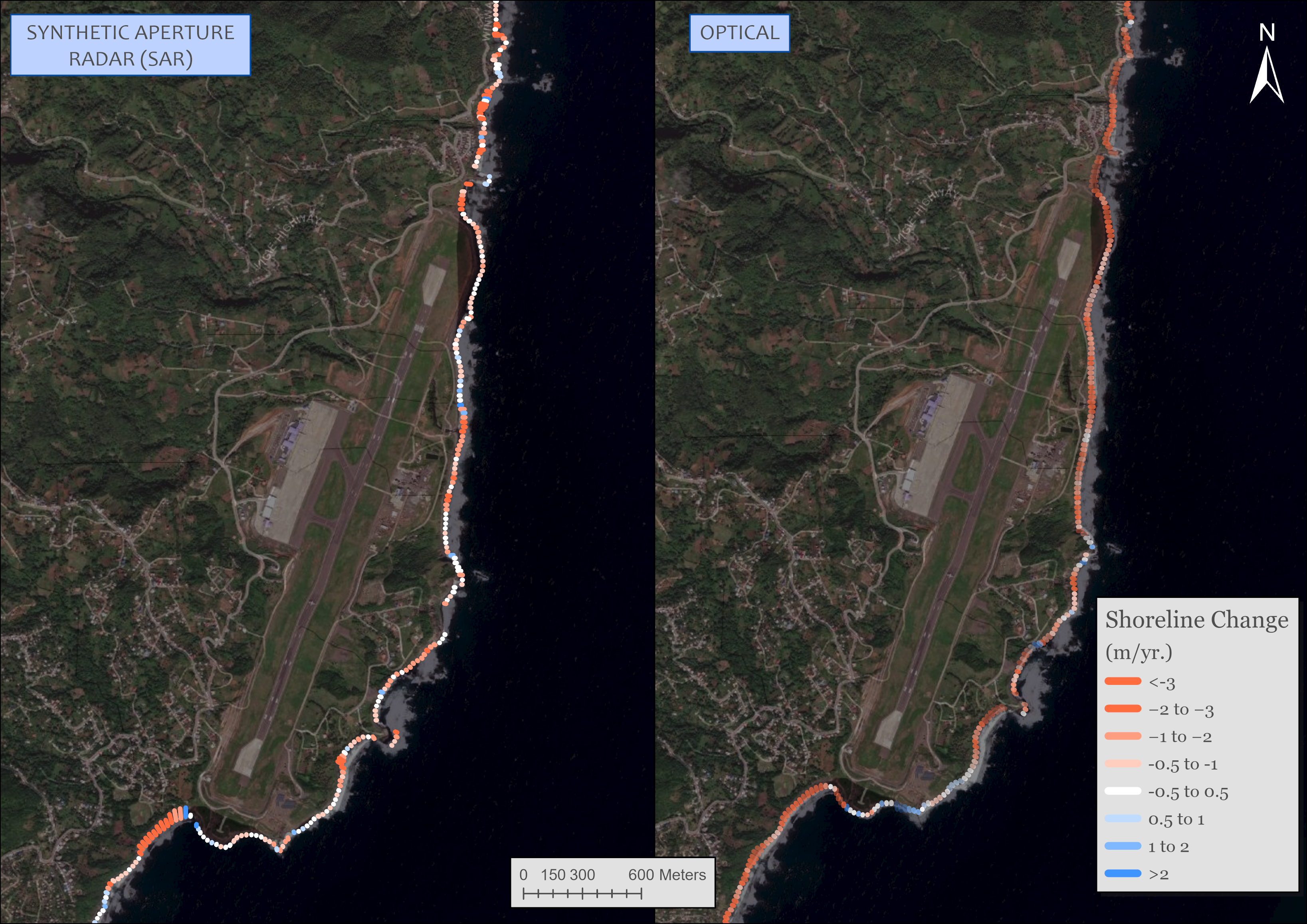
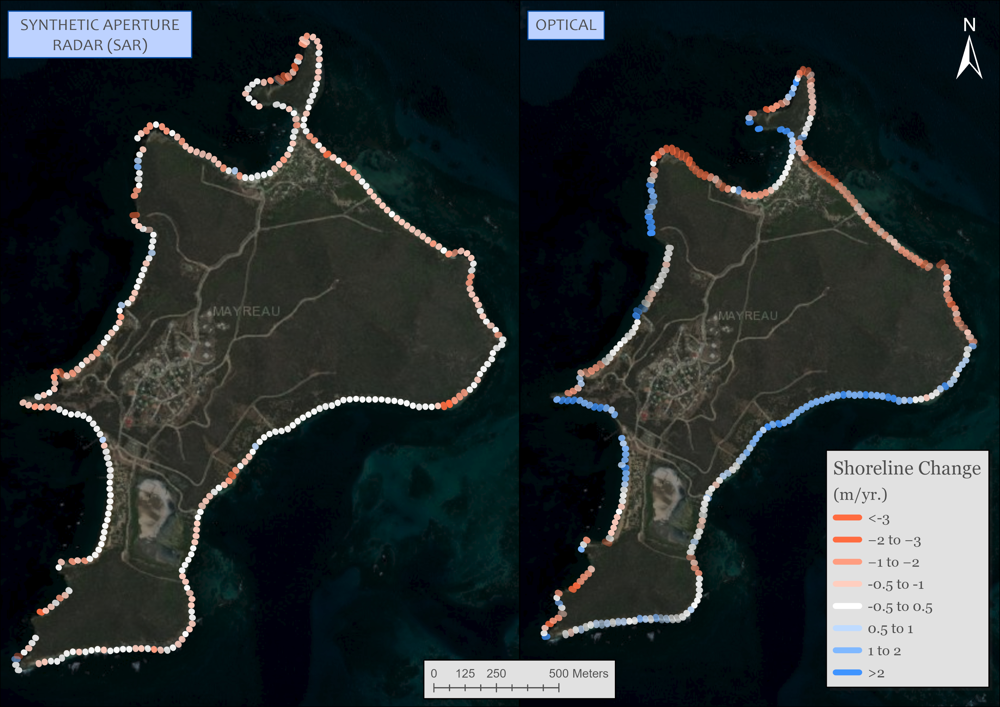
The images above illustrate the change rate data from Sentinel-1 and 2 in Mayreau and Argyle Airport