Portfolio
 |
Support for Marine Protected Area managementPlanning and management of Marine Protected Areas focuses on the need to protect marine flora and fauna, but has to be considered in the context of other uses of marine space. Information from EO data can support this process. |
|
 |
Coastal habitat mappingThis service will provide maps of selected coastal areas, covering dunes and coastal wetlands, estuaries, lagoons, and mangroves. The maps may be used to plan and monitor environmental protection measures, and inform integrated coastal zone management. |
|
 |
Coastal bathymetry mappingIn clear, shallow waters, where the bottom is visible to several meter’s depth, it is possible to retrieve bathymetry from optical satellite data. This is helpful in regions that lack accurate sonar-based bathymetry data. The accuracy of the retrieved bathymetry decreases with water depth. |
|
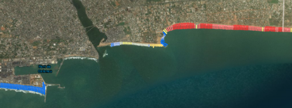 |
Shoreline mapping and change detectionShoreline changes due coastal erosion or sediment deposition can be substantial in some areas - even over just a few years. Satellite monitoring is a powerful technique for monitoring these changes. EO-derived coastline maps may be combined with tidal modelling to also yield crude bathymetric maps of the intertidal region. |
|
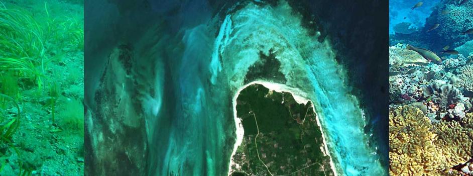 |
Benthic habitat mappingMaps of the main benthic habitat types (macroalgae, live coral, seagrass beds, sand and other bare substrates) can be derived from high resolution satellite data, simultaneously with shallow water bathymetry. Maps may be produced without input from in situ surveys, but combining satellite data measurements from targeted surveys by local experts can improve accuracy. |
|
 |
Coastal land use changeMonitoring of land cover and associated changes in coastal areas is an important part of environmental protection. Sediment transport in rivers responds to soil erosion caused by land use changes in watersheds, and may have direct influence on coastal water quality. |
|
 |
Water qualityOcean colour products including chlorophyll-a concentration, suspended sediments and water clarity can be provided over a large region at 1km or 300m resolution. In selected regions higher resolution maps (down to 10 m) can be delivered for monitoring of suspended sediments or dense algal blooms. |