Homepage
The Blue Economy approach to the oceans supports economic growth, social inclusion and improvement of livelihoods, while also ensuring the continued health of coastal and marine ecosystems and the services they provide. This takes careful planning and management, based on a sound understanding of marine and coastal environments. However, these areas are expensive and challenging to measure and monitor using in situ techniques alone. In many cases, there are no viable alternatives to EO for providing the information decision-makers need to build a sustainable blue economy.
Since 2008 the European Space Agency (ESA) has worked closely with Multilateral Development Banks (MDBs) and their Client States to harness the benefits of Earth Observation (EO) in global sustainable development. Earth Observation for Sustainable Development (EO4SD) is a new ESA initiative that aims to increase EO-based information uptake in regular development operations at national and international levels.
Billions of people worldwide rely on the oceans for food and jobs. Around 60 million people are involved in fisheries and aquaculture – most of them in small scale fisheries in developing countries. Healthy oceans and coasts are essential for economic growth and food production and the health and well-being of local populations. Coastal and marine environments are often rich, with high levels of productivity and biodiversity, but they are also vulnerable to climate change and pressures from human activities.
The value of Earth Observation
Watch this short video to get an overview of the value of Earth Observation in the context of world banking organisations
Objectives
EO4SD-marine will work with a range of stakeholders to define and implement a large-scale demonstration of how EO-derived information can support sustainable development activities in marine and coastal environments. Specifically, we aim to demonstrate the use of EO to support, for example:
-
Mapping of coastal bathymetry, coastline change, and changes in coastal land cover and land use
-
Mapping the extent and status of benthic habitats such as coral reefs, macro-algae and seagrass beds
-
Monitoring of water quality and marine pollution
-
Assessments of coastal habitat extent and status
-
Monitoring of coastal environments required for the planning, implementation and management of marine protected areas
-
Surveillance of illegal and unreported fisheries
-
Monitoring of economic activities such as aggregate extraction and dredging
-
Marine spatial planning and the selection of suitable sites for aquaculture and other activities to develop blue economy activities such as tourism, transportation, and marine energy generation
Portfolio
Our portfolio of EO-derived products and services is currently being developed in consultation with a range of stakeholders in International Financing Institutions (IFIs) and their Client States. As detailed specifications become available for each service, more information will be available on this website and a complete portfolio brochure. See below for examples of potential services.
-

Support for Marine Protected Area management
Planning and management of Marine Protected Areas focuses on the need to protect marine flora and fauna, but has to be considered in the context of other uses of marine space. Information from EO data can support this process.
-

Coastal habitat mapping
This service will provide maps of selected coastal areas, covering dunes and coastal wetlands, estuaries, lagoons, and mangroves. The maps may be used to plan and monitor environmental protection measures, and inform integrated coastal zone management.
-

Coastal bathymetry mapping
In clear, shallow waters, where the bottom is visible to several meter’s depth, it is possible to retrieve bathymetry from optical satellite data. This is helpful in regions that lack accurate sonar-based bathymetry data. The accuracy of the retrieved bathymetry decreases with water depth.
-
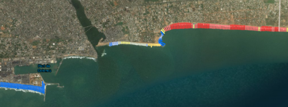
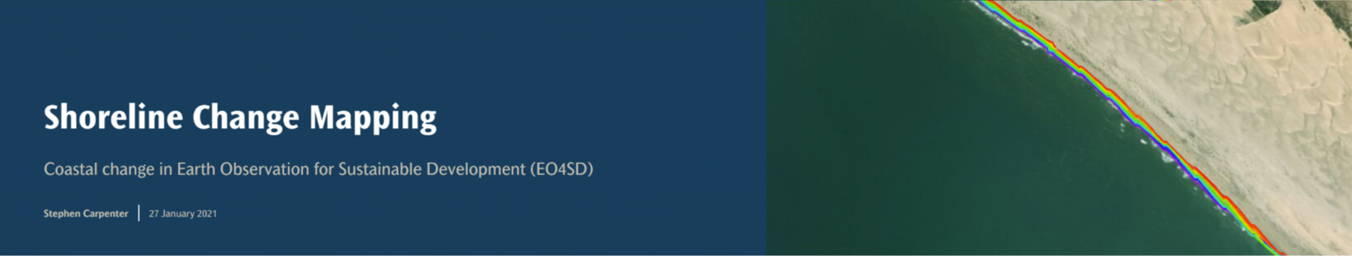
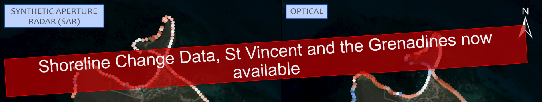
Shoreline mapping and change detection
Shoreline changes due coastal erosion or sediment deposition can be substantial in some areas - even over just a few years. Satellite monitoring is a powerful technique for monitoring these changes. EO-derived coastline maps may be combined with tidal modelling to also yield crude bathymetric maps of the intertidal region.
-
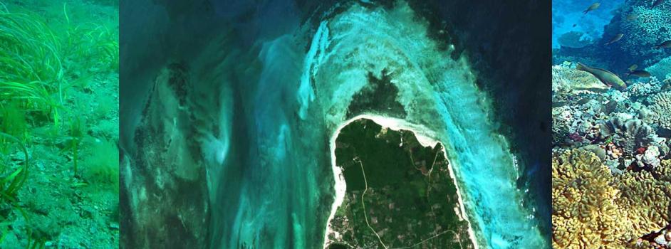
Benthic habitat mapping
Maps of the main benthic habitat types (macroalgae, live coral, seagrass beds, sand and other bare substrates) can be derived from high resolution satellite data, simultaneously with shallow water bathymetry. Maps may be produced without input from in situ surveys, but combining satellite data measurements from targeted surveys by local experts can improve accuracy.
-

Coastal land use change
Monitoring of land cover and associated changes in coastal areas is an important part of environmental protection. Sediment transport in rivers responds to soil erosion caused by land use changes in watersheds, and may have direct influence on coastal water quality.
-

Water quality
Ocean colour products including chlorophyll-a concentration, suspended sediments and water clarity can be provided over a large region at 1km or 300m resolution. In selected regions higher resolution maps (down to 10 m) can be delivered for monitoring of suspended sediments or dense algal blooms.
Project Consortium
The project is implemented by a consortium of specialist service providers in the European Earth Observation sector. The consortium integrates EO technical proficiency and a wide experience in developing geospatial operation services in the marine and coastal domain: National Oceanography Centre (United Kingdom) (lead), Brockman Consult (Germany), University of Twente - ITC (The Netherlands), Plymouth Marine Laboratory (United Kingdom), University of Tartu (Estonia), Arup (United Kingdom) and Seven (Greece).
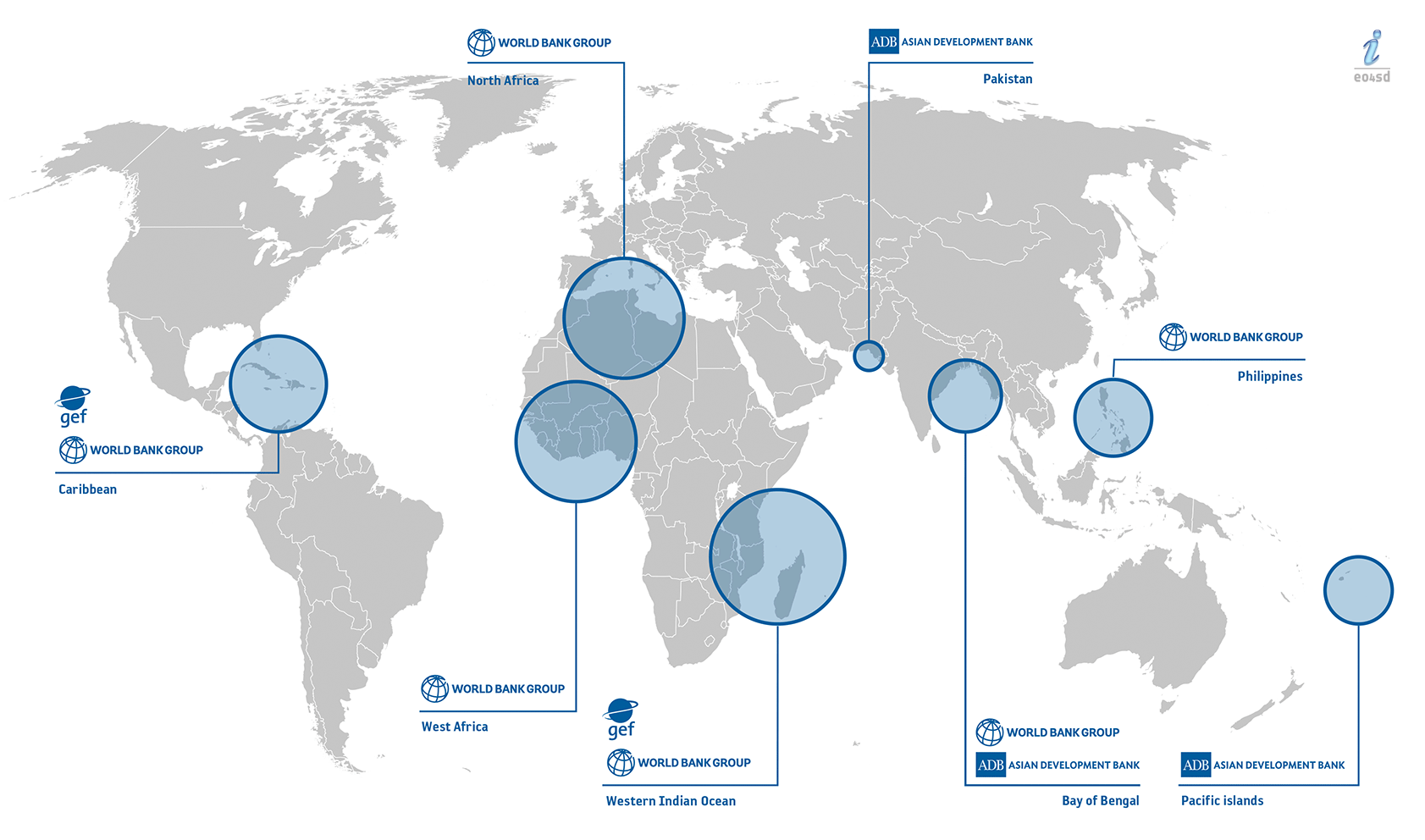
Where We Work
The EO4SD Marine and Coastal project aims to to develop and demonstrate the provision of customised information services to support the operations of the following IFIs (international financing institutions): the Global Environment Facility (GEF), the World Bank Group (WBG), the Inter-American Development Bank (IADB) and the Asian Development Bank (ADB).
A preliminary list of case studies are being developed in consultation with these institutions and representatives of regional initiatives in the regions indicated below.
See our data portal for data available for these regions.